9 Little Known Facts About Maui

Think you know everything about the island of Maui? You might want to think again.
There are a lot things people already know—like the fact that Maui is home to some of the best whale watching in the world—but this island has such a fascinating history that even longtime visitors (and locals!) might be surprised at some of these facts about our island home:

1.There Used To Be A Horse Racing Track on Ka‘anapali Beach
Horse racing on Ka‘anapali Beach? Hard to believe, but true!
Before it was a popular West Maui resort (and where we start our Ka‘anapali snorkeling tours), Ka‘anapali Beach was a massive swath of wide, undeveloped sand.
Horses were introduced to Hawaii in 1803, and by the mid 1800’s ranching was one of Hawaii’s largest industries. Rodeo and racing quickly became popular, and the races became favorite past times for royalty who would gamble, socialize, and mingle with many of the island’s most prominent businessmen.
Here in West Maui the largest horse track was on Ka‘anapali Beach, and was named the Koko O Na Moku track after the famous 18th century battle that raged across West Maui. Races began in the 1880s, and while the last official race was held in July, 1918, unofficial races continued through the early 1920s.
So where exactly was the track located?
It stretched from modern day Ka‘anapali Beach Hotel all the way down past the Whaler condos, Whaler’s Village Shopping Center, and The Westin.
Groves of kiawe trees bordered the track, and there was even a grandstand and special seating for VIP gamblers and spectators.

2. The Islands of Maui, Lanai, Molokai, and Kaho‘olawe Are Actually One Island Named “Maui Nui”
You know all of those islands you see when standing on the beach in Lahaina? There was actually a time when they were all connected—and they could be again in the future!
Named Maui Nui (which translates as “Big Maui”), this island was 5,600 square miles, or 40% larger than Hawaii Island currently is today.
When compared to states on the US Mainland, it would have been slightly larger than Connecticut, and when compared to international destinations, it would have been larger than Jamaica or Lebanon, and half the size of Belgium.
It’s comprised of seven different volcanoes (one of those being the Penguin Bank, now submerged off Molokai’s west coast), and Maui Nui reached it’s largest size about 1.2 million years ago.

HVO scientists/USGS, Public domain, via Wikimedia Commons
Prior to that, about 2 million years ago, there was even a time when the island of O‘ahu was also connected to Maui Nui—although it only lasted about 300,000 years, and Haleakala wasn’t nearly as close to the size it is today.
Since that time, erosion and change in sea surface height have slowly divided and separated the islands into the ones we see here today. The connection between Maui and Moloka‘i collapsed 600,000 years ago, and Kaho‘olawe broke from Maui between 150,000-200,000 years ago.
That said, it was only about 18,000 years ago during a period of “glacial maximum” that the islands of Maui, Molokai, and Lanai were still connected via a land bridge with the island of Lanai as the “joint.” Maui and Molokai weren’t directly connected, and once the polar ice caps began melting, and sea levels started to rise, they rose at a rate of about .6 inches/year until reaching current levels.
Amazingly, over the past 1 million years, the islands of Maui Nui have been connected for 75% of that time!
Looking toward the future, there’s the chance if that were ever to be another ice age (or scientifically, “glacial maximum”), the submerged land bridge between Maui and Lanai could once again be exposed. At the shallowest point, there is currently a ridge between the two islands that never reaches a greater depth than about 108 feet!

3. Honoapi‘ilani Highway Is Named After A 16th Century King
Knowing proper place names in Hawaii opens up a whole new understanding and appreciation for these islands.
Visitors might know it as “Highway 30,” (or the road around West Maui), but calling it by it’s name—Honoapi‘ilani— helps illuminate one of Maui’s most formative times in ancient history.
In the 16th century, Pi‘ilani was a ruler of Maui whose reign was one of peace, prosperity, and tremendous growth on the island. One of his projects was building a footpath that encircled the entire island, which came to be known as the alaloa, or as some call it, the “King’s Trail.”
This path was used for collecting taxes and for land travel between villages, and was predominantly used by ruling ali‘i, or their highest class of advisors.
While the path was begun by Pi‘ilani, it was ultimately finished by his son, Kiha-a-pi‘ilani, who, after a very brief war with his brother, seized control of Maui.
Here in West Maui, the trail connected six of the bays where Pi‘ilani would travel, which in Hawaiian were called Na Honoapi‘ilani (“the bays of Pi‘ilani”).
Those six bays were:
Honokowai (“Bay Drawing Fresh Water”)
Honokeana (“Cave Bay”)
Honokahua (“Sites Bay”)
Honolua (“Twin Bays”)
Honokohau (“Bay Drawing Dew”)
Hononana (“Animated Bay”)
While the original footpath is gone in West Maui (but can still be found in South, and East Maui), the name lives on in West Maui’s highway that connects the beautiful, sheltered bays, and allows us to travel this stretch of coast like Hawaiian royalty before us.
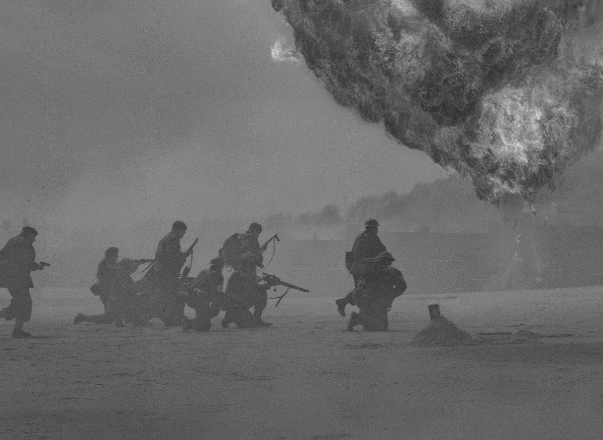
4. Maui Was Attacked in World War II
Just days after bombing Pearl Harbor, on Oahu, Japanese submarines fired artillery shells at Kahului Harbor here on Maui. The first occurrence was on December 15, and then again on December 31.
A few shells struck the pineapple cannery at Kahului Harbor, and though the damage was minimal, there was one death attributed to the shelling—a very unlucky chicken.
More severe was the Japanese attack on the military transport boat, Royal T. Frank, which happened in the ‘Alenuihaha Channel between Maui and Hawaii Island. Japanese submarines sank the ship with torpedoes, and 24 sailors were killed. The 30 sailors who survived the strike were loaded in lifeboats and paddled to Hana, along Maui’s eastern shore.

5. Some Of The Coral At Olowalu Is Believed To Be 500 Years Old!
When you sail with Trilogy on one of our Discover Olowalu tours, you’ll have the chance to view some of Maui’s oldest coral firsthand.
There are fields of bright, colorful lobes that are believed to be over 500 years old, and when that coral spawns, polyps form on the water’s surface— which then drift to neighboring reefs before settling and forming new colonies.
Since this spawn has been traced to other reefs in West Maui (and even some reefs on the neighboring islands of Molokai and Lanai!), Olowalu has earned it’s nickname of Maui’s “Mother Reef.”
And, in addition to covering nearly 1,000 acres, the reef here at Olowalu is also home to one of Maui’s largest manta ray populations, as well as a couple of rare coral species not found in other West Maui waters.
In 2017, Olowalu was named a “Hope Spot” by the marine biologist, Dr. Sylvia Earle, and joins dozens of other spots around the planet as places of exceptional biological import that are in need of greater protection.

Credit: Images of Old Hawaii / Herb Kane
6. A 16th Century Spanish Map Refers To Maui As “El Desgraciado”… 200 Years Before Captain Cook “Discovered” the Hawaiian Islands!
It’s generally accepted that Polynesian voyagers were the first humans in Hawaii, when they sailed here from French Polynesia around 300-500 AD.
It’s also been taught that the British explorer, Captain Cook, was the first European to “discover” Hawaii, and that the French explorer, La Perouse was the first European to set foot on Maui at Ke‘one‘oi‘o Bay (a few miles south of Wailea and Makena).
As early as the late 1800s, however, serious discussions starting taking place that the Spanish knew about the Hawaiian Islands a full 200 years before Cook.
Beginning in the 1520s, Spanish ships known as galleons would cross the Pacific as they moved silver and gold from Mexico to Indonesia and the Philippines. In 1555, it’s nearly certain that n one of those crossings, the Spanish explorer, Juan Gaetano, sailed his ship through Hawaiian waters and noted them on his charts.
Though the islands he charted are on the same latitude as Hawaii, they’re listed as 10 degrees to the east—an easy error in dead reckoning at such an early date (for what it’s worth, the Spanish are also believed to have “found” The Solomon Islands—but were so bad at navigation they “lost” the islands and couldn’t’ find them again for 150 years).
On Gaetano’s map of the Hawaiian Islands, one of the islands is labeled La Mesa (“The Table”), and likely references the “tableland” appearance of Mauna Loa volcano. Additionally, the southern coastline of the island on the chart is impressively similar to the actual southern coast of Hawaii Island.
The other islands listed in the group are one called El Desgraciado (“The Unfortunate”), which is surrounded by three smaller islands Gaetano labeled Los Monges (“The Monks”). From their size and position, it’s likely the “The Unfortunate” was the island of Maui, and “The Monks” were the three surrounding islands of Kaho‘olawe, Moloka‘i, and Lana‘i.
The Spanish were very secretive about all their Pacific discoveries, but in 1743, an English ship captained by Lord Anson successfully captured a Spanish ship that had galleon charts onboard.
While it isn’t believed that Captain Cook ever got his hands on the charts, La Perouse obtained the charts, and when he set out to find the island of La Mesa, he sailed directly to Hawaii Island and was convinced that the islands Gaetano had labeled were in fact the Hawaiian Islands.

7. In the 1930s, the “pali” section of Honoapi‘ilani Highway Used To Be Called “The Amalfi drive of Maui”
You know when you’re driving between Ma‘alaea and Lahaina, and you wind your way along a section of road with cliffs, rock slides, and a tunnel?
That section of road is what locals call the Pali—the Hawaiian word for cliff.
Before 1600 AD, anyone wanting to travel to Lahaina would either need to travel by canoe, or make the harrowing hike through the mountains through Iao and Olowalu valleys.
By 1825, a footpath was constructed that went up an over Kealaloloa Ridge, which is the area where you now see windmills twirling above Ma‘alaea Harbor ( which is the starting point for our Molokini snorkeling tours). Soon people started traveling it on horseback, although the trail also became notorious for robbers who would hide behind stones on the trail.
By the 1880s a wider path was built along the coast, and horse and carriages started to make the winding, bumping journey.
In 1911, prison laborers turned the path into a road, and throughout the 1930s and 40s, this road was called “The Amalfi Drive of Maui” for its scenic twists and curves. Rather than gazing at the Mediterranean, however, as you would on Italy’s Amalfi Drive, travelers to Maui are instead treated to sweeping views of the big blue Pacific—and in winter, breaching whales!
Finally, in 1951, after a tunnel was blasted through the cliff above Papalaua, Honoapi‘ilani Highway took the form that travelers know today.
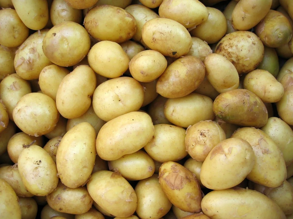
8. Potatoes For The California Gold Rush and Cotton For The US Civil War Were Both Grown on Maui
Before there were pineapples, coffee, and sugar, Maui’s slopes were covered (briefly) with fields of potatoes and cotton!
Remember that for most of the 1800s, the Hawaiian Kingdom was its own sovereign country that held international trade agreements with foreign nations—like America.
In places like Kula, as well as Rose Ranch (known today as ‘Ulupalakua Ranch), potatoes were grown in the fertile soil and then shipped to San Francisco to feed thousands of hungry prospectors hoping to strike it rich.
Meanwhile, the potato trade was such good business, that Maui’s potato farming areas earned the nickname of “Nu Kaleponi”—or “New California” for the financial fortune that could quickly be made in agriculture—not gold.
Then, when railroads arrived in California it killed Hawaii’s potato trade, and farmers briefly switched over to cotton, since the US Civil War had halted the Union’s ability to get cotton crops from the South.
Who knew?!

Credit: Hawaii Undersea Research Laboratory
9. The Largest Deepwater Reef In The World Is Less Than A mile Off Lahaina
Recently, in deep parts of the ‘Au‘au Channel between Maui and Lanai (between 100-500 feet), researchers have found the world’s “largest uninterrupted coral ecosystem that’s ever been recorded.”
While some sections of seafloor are sand, others contain swaths of deepwater coral that at some points cover 3 square miles —larger than anywhere else on Earth!
Since the ‘Au‘au Channel is essentially protected by islands on all four sides, it’s largely shielded from currents and waves that would rip the coral apart.
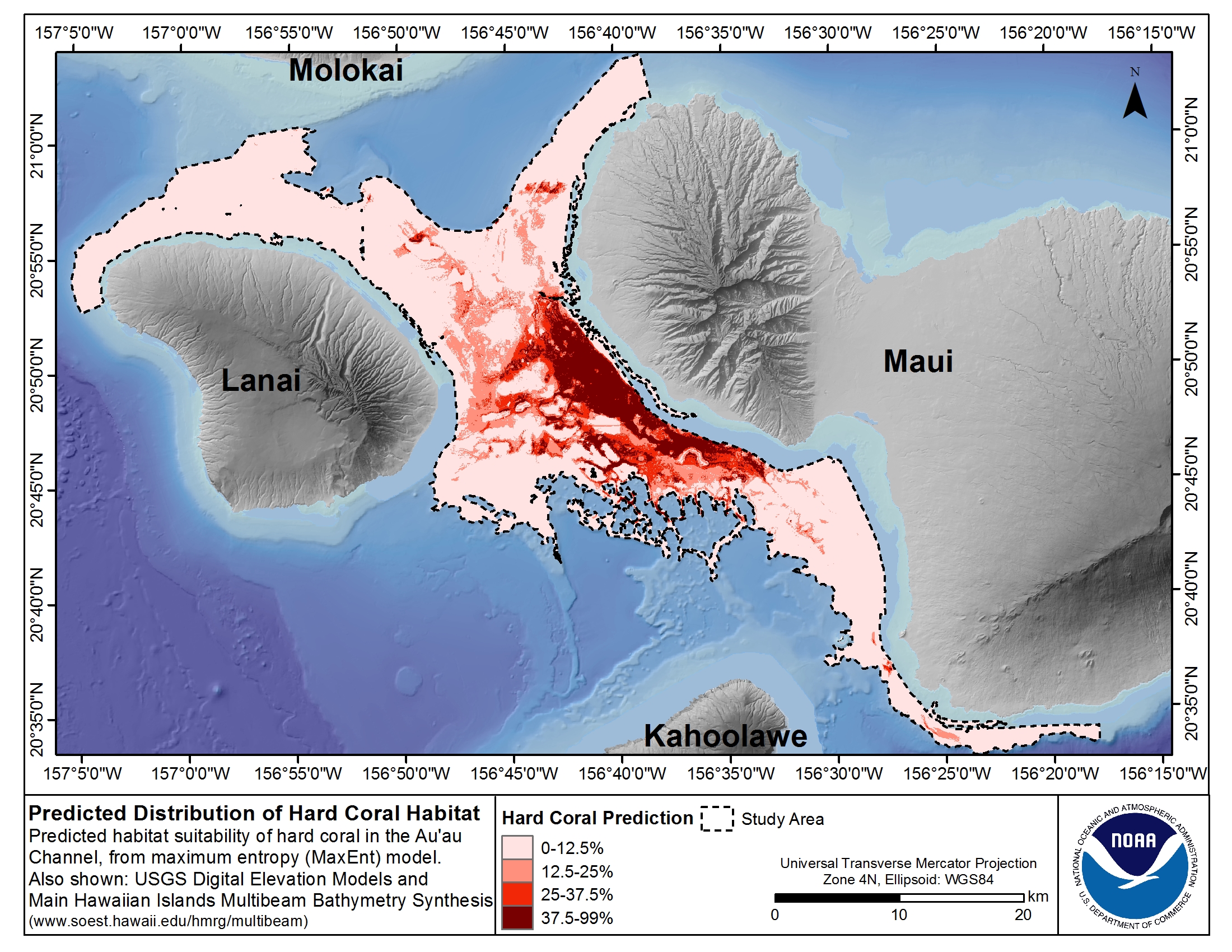
What’s even MORE AMAZING, is that researchers have found that endemism increases the deeper you go in the channel, which basically means the percentage of endemic species (species found nowhere else in the world) steadily increases with depth. Whoa!
“Shallow” reefs in Hawaiian waters (like the ones we visit on our Maui snorkeling tours) have 17% endemic species, whereas once you drop past 200 feet, over 50% of species on the reef are endemic to here in the islands.
It’s the “oceanic twilight zone,” and researchers are just beginning to understand what exactly might be down there…